Sunday, July 15, 2012.
True to our form on this trip, we left Winnipeg
early morning and headed south for the border, this time the crossing on
highway 59. I wanted to make an attempt
to locate the cemetery at Plankey Plains.
Looking around the previous day had jogged my memory to its approximate
location. There is no longer a sign on
highway 59 pointing the way east to Stuartburn, Manitoba, but only to another
town settled by Ukrainians, Vita. I
remembered that on a previous visit with another cousin we had crossed highway
59 on the road, driving west on highway 201.
The road to Plankey Plains, which is no longer on the road map of
Manitoba, is named 28E going north.
Once arrived we almost missed it. The west side of the road where Plankey
Plains church once stood, and on the last visit where one building remained is
now empty except for the sign with grass grown up all around commemorating
where the church once stood. Looking
through the grass you will see the entry way steps—the only part of the church
still preserved. Here is where family
members, some of whom I knew, were married, baptized, and buried.
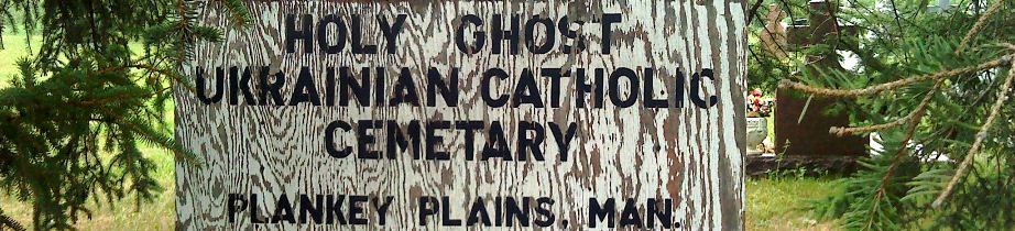
On the east side of the road the cemetery is hidden
by trees, the sign peeking out from the tall firs. I am glad to see that the grass has been
clipped. Some of the old grave markers
have been replaced. In the area where
the Gorman plots are located I can see that some are missing, fallen over or
decayed from rain and harsh winters, names worn off. We get out a pencil and try to mark the
indentations so that we can read the names, and do some rubbings. I am moved by my memories, and this is not a
bad thing. The emotions are generated
from the love that existed between me and those now gone, and by the loss of
those who died in their prime whom I would like to have known. But now I feel we can leave. There is more to do, and we are on our way.
No comments:
Post a Comment
Thank you for your comment. Your comment will be moderated shortly.